
Say "Savoie" and images immediately spring to mind: Mont Blanc, church steeples nestled amidst alpine pastures, the shores of Lake Annecy, the high mountain passes of Maurienne, vineyards clinging to the slopes above Chambéry, the chalets of the Beaufortain region, or Lake Geneva, an immense blue expanse bordered by the mountains of Chablais. Yet, behind these familiar landscapes lies a rather difficult question: What is Savoy?
A department, of course. But not only that.
Because there is also a Haute-SavoieAnd when we talk about Savoy CountryThe two current departments are generally grouped together, even though no administrative region bears that name. The expression "historical Savoy" is still encountered, which goes beyond our contemporary administrative representations and refers to several centuries during which this territory belonged to states whose political center eventually became located on the other side of the Alps, in Turin.
Savoy was first a county, then a duchy. It gave its name to a dynasty that ruled over territories stretching, at times, from Lake Geneva to the Mediterranean and as far as Piedmont, before becoming the royal house that led the unification of Italy. It was French during the Revolution and the Empire, became Sardinian again in 1815, and was then definitively annexed to France in 1860.
And yet, more than a century and a half after this annexation, The idea of Savoy has not disappeared.
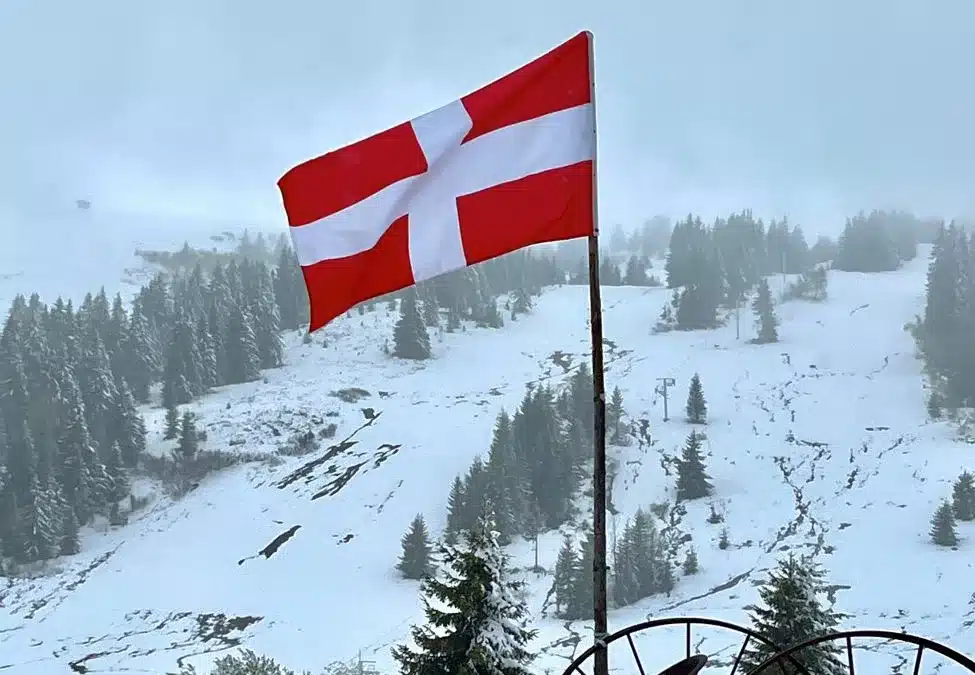
It survives in a shared history, in landscapes, traditions, languages, architectures, agricultural products, the white cross on a red background and above all in this curious feeling of belonging to a territory whose current administrative borders are not quite sufficient to tell the story of its identity.
To understand the Savoy CountrySo, we need to look at a map. But we also need to go back in time.
What is the Savoy region today?
Let's start with the simplest thing: The Savoy region does not constitute a French administrative region.
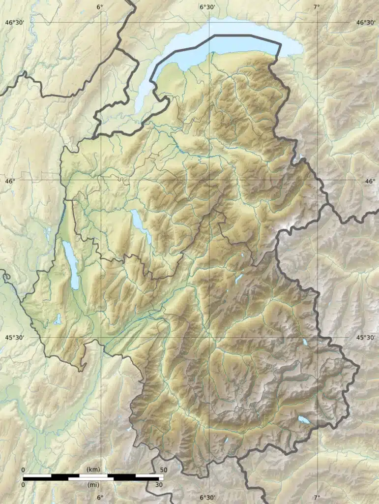
In its most common contemporary usage, the expression refers to the whole formed by the two departments of the Savoy (73) and Haute-Savoie (74)Larousse defines Savoy as a historical region in the northern French Alps corresponding to the two current departments.
Both departments now belong to the region Auvergne-Rhône-Alpes, but they retain geographies and identities strong enough for the expression Savoy Country continues to make sense. We also say "the two Savoys" or "the Savoys", with the word Savoy in the singular of course since it is a proper noun.
And you only need to go through them to understand why the term "country" in the plural of "country of Savoy" is particularly appropriate.
To the north extends the Geneva, a vast, almost maritime horizon shared with Switzerland. Évian-les-Bains and Thonon-les-Bains look directly towards Lausanne, while Geneva exerts considerable economic influence over a large part of Haute-Savoie.
Further south appear the mountain ranges of Chablais and Faucigny, then the Arve valley which goes up to Chamonix and to the Mont Blanc massif.
AroundAnnecyThe landscape changes again. The lake, the wallows, the Aravis and the Bornes create a more open mountain range, made up of limestone cliffs, forests and alpine villages.
In Savoy, Chambéry occupies an almost opposite position. The city lies at the meeting point of the Pre-Alps and the great inland valleys. To the west begin the Savoyard foothills and the Aiguebelette lake ; to the north, the Bourget lake stretches as far as the Rhône; to the east, the Isère valley successively opens the Beaufortain and the Tarentaise while that of the Arc penetrates deep into the Maurienne.
At the end of these valleys, the great mountains appear: Vanoise, the mountain passes of Mont-Cenis, Iseran, and Galibier accessible from the beautiful valley of the Mauritian and glaciers and peaks well exceeding 3,000 meters.
The Savoy region therefore forms less of a single landscape than a extraordinary succession of alpine territories.
This is, in fact, one of the keys to their story.
Why do we refer to the "Pays de Savoie" in the plural?
The plural form first of all avoids an obvious confusion between the historical Savoy and the current Savoie department.
When the former Savoyard territory was integrated into France in 1860, it was divided between two new departments: the Savoie, with Chambéry as its prefecture, and the Haute-Savoie, with Annecy.
Therefore, speaking of the "Pays de Savoie" allows us to rediscover a unity that predates this administrative separation.
But the plural also has a much deeper geographical meaning.
Savoy has always been made up of valleys and highly individualized countriesTravel was difficult, especially in winter. Trade naturally took place along the valleys and across the mountain passes, creating territories each with its own economy, customs, sometimes linguistic variations, and architecture adapted to different climatic conditions.
A resident of the Chablais region naturally turned their gaze towards Lake Geneva. A Maurienne native lived along a major transalpine route leading to Mont Cenis. The Tarentaise region followed the Isère River to the passes that allowed access to the Aosta Valley. The Faucigny region was structured by the Arve Valley. Chambéry controlled the roads coming from France and leading into the heart of the Alps.
This diversity remains perfectly visible today.
There is indeed a shared Savoyard identity, but Building, farming, and living are not the same in Yvoire, Beaufort, Chambéry, or Bonneval-sur-Arc..
To understand this mosaic, we must go back to the origins of Savoy.
How did Savoy come into being?
Before Savoy, a territory in the heart of the Alps
Savoyard history obviously does not begin with the Counts of Savoy.
In ancient times, a significant portion of the territory was occupied by the AllobrogesThe Gauls were a Gallic people whose territory extended well beyond the current borders of Savoy. Rome gradually conquered the region from the 2nd century BC. After the Roman period came the Burgundians, then the Franks; the territory then passed into various entities resulting from the division of the Carolingian Empire before being attached to the Kingdom of Burgundy and then to the Holy Roman Empire in the 11th century.
But in this medieval Europe where authority is fragmented between lords, bishops and aristocratic families, one dynasty will gradually take on considerable importance.
That of Humbert of the White Hands.
Humbert of the White Hands and the birth of the House of Savoy
At the beginning of the 11th century, a person named Humbert appears in documents, whom tradition will later call Humbert of the White Hands.
He owned or controlled various territories around the Western Alps, originating from his birthplace in Maurienne, and enjoyed the trust of the rulers of the Kingdom of Burgundy and later the Holy Roman Empire. His possessions obviously did not correspond to present-day Savoy: they formed a discontinuous collection spread around the major Alpine passes.
But the strategy that will make his descendants rich is already perceptible.
The Alps are not just a barrier, but also a route.
Controlling the mountain passes, the valleys leading to them, and the tolls required to cross them gave the House of Savoy considerable political and economic importance. Its territories gradually expanded. on both sides of the Alps.
This is a fundamental element for understanding the whole of Savoyard history: for centuries, the Alps did not constitute the eastern border of Savoy. Rather, they formed its backbone.
Chambéry becomes the political heart of Savoy
The House of Savoy is gradually strengthening its presence around Lake Bourget and the Chambéry valley.
In the 13th century, Chambéry Chambéry became the main political center of the counts. Its castle, gradually enlarged, became a dynastic residence and the seat of an increasingly organized administration. Historical sources place the establishment of Chambéry as the capital of the Savoyard states in the 13th century.
The city's location is remarkable.
From Chambéry, roads lead towards Lyon and France, Geneva and Lake Geneva, Grenoble and the Dauphiné region, but also towards the Maurienne valley and the Mont-Cenis, an essential passage to reach Piedmont.
Geography once again explains politics.
For several centuries, Chambéry thus became a capital located at the heart of a state that was gradually being built around the Alps.

1416: Savoy becomes a duchy
The central figure of this period is Amadeus VIII.
Under his reign, the possessions of the House of Savoy underwent a period of remarkable consolidation. 1416Emperor Sigismund elevates the County of Savoy to the rank of DuchyAmadeus VIII thus became the first Duke of Savoy.
The event goes beyond a simple question of title. It reflects the importance the dynasty has acquired within Western Europe.
The Savoyard states still did not constitute a homogeneous country. They were composed of a multitude of territories with their own institutions, privileges, and traditions. But all gradually recognized the authority of a single sovereign house.
During the 14th and 15th centuries, the latter also extended its possessions to the south and east. The acquisition of Nice in 1388 gives him a access to the Mediterranean. The Piedmont takes on increasing importance and is integrated into the states of Amadeus VIII at the beginning of the 15th century.
Savoy then became the western heart of a much larger political entity.
And it is precisely this extension that will eventually shift its center of gravity.
From Chambéry to Turin: when power crosses the Alps
In the 16th century, the geopolitical situation became increasingly difficult for the Dukes of Savoy.
Their territories were caught between two great powers: France to the west and the Habsburgs to the east. Savoy was occupied by the French for much of the reign of charles iii.
His son, Emmanuel-Philibert, manages to recover his states after the victory of Saint-Quentin and the treaties of Cateau-Cambrésis in 1559.
But he draws a strategic conclusion from it.
The center of its possessions should no longer be in Chambéry, which is too close to France and too vulnerable.
Power is transferred to Turin in 1563 — some sources cite 1562 for the transfer process — and the fate of the Savoyard states gradually shifted towards the Italian side of the Alps.
For Chambéry, the change is considerable.
The city retains an important administrative and symbolic role, but it is no longer the capital of a European state.
To understand Savoyard architecture, culture and even some traditions today, one must keep this history in mind. Savoy lived for several centuries in a political space that looked towards Turin as much as towards France.
This explains the sometimes Italian impression found in certain streets of Chambéry, in the baroque religious architecture of the high valleys, or in many surnames.
From the Duchy of Savoy to the Kingdom of Sardinia
The rise of the House of Savoy did not stop at the ducal title.
At the beginning of the 18th century, the major European conflicts allowed Victor Amadeus II to obtain a royal crown. The Treaty of Utrecht of 1713 granted him Sicily. A few years later, this was exchanged for the Sardaigne.
From 1720 onwards, the sovereign of the House of Savoy therefore bore the title of King of Sardinia in addition to the other titles of Duke of Savoy, Prince of Piedmont, etc…
The kingdom notably includes Savoy, Piedmont, Nice and Sardinia, with Turin for political capital.
The situation may seem paradoxical when looking at a contemporary map of France: for more than a century before its annexation to France, Savoy belongs to a kingdom whose political and economic center is in ItalyBut it must be kept in mind that what is important at this time is to control both sides of the mountains.
It was this kingdom of Sardinia, dominated by Piedmont and ruled by the House of Savoy, which would later play a decisive role in Italian unification.
But before getting to that point, the French Revolution would disrupt the borders for the first time.
The former provinces of Savoy: six territories to understand the country
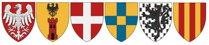
source: https://www.guides-patrimoine-savoie-mont-blanc.fr/des-provinces-histoires/
in order of coats of arms: Tarentaise, Maurienne, Savoie Propre, Genevois, Chablais, Faucigny.
Talking about the "six historical provinces" is useful for understanding Savoyard geography, provided one precaution is added: The administrative divisions of Savoy have evolved over the centuriesThe borders, the names, and even the number of provinces were not immutable.
However, we can distinguish six major groups which still very strongly structure our representation of historical Savoy located today in France.
Clean Savoy: around Chambéry
His name sometimes surprises people. Clean Savoy obviously does not mean that the rest of Savoy would be "unsuitable": the expression refers to the historical heart of the Savoyard territory around Chambéry.
It includes in particular the Chambéry valley, the Savoyard foothills and extends towards the Combe de Savoie as far as Ugine, the Val d'Arly and the Beaufortain.
This is Savoy from Dukes' Castlevineyards overlooking the valley, Lake Bourget and the first foothills of the Bauges and Chartreuse mountains. Above all, it occupies an exceptional strategic position at the entrance to the great Alpine valleys.
The Geneva region: Annecy and its hinterland
The name might suggest that its capital is Geneva.
The story is more complicated.
Le Genevan Savoyard It gradually became organized around Annecy, particularly after Geneva's political and religious assertion outside the Savoyard sphere of influence. Annecy became a major center, especially during the Reformation and Counter-Reformation.
Even today, the Geneva region presents a very different identity from the great inland valleys: pre-alpine landscapes, Lake Annecy, proximity to Geneva and openness towards the Aravis and the Val d'Arly.
The Chablais region: between Lake Geneva and the mountains
Le Chablais naturally looks towards Lake Geneva.
Thonon-les-Bains, Évian-les-BainsYvoire and the villages on the French side belong to this world where the lake has always structured communications, exchanges and landscapes.
But just a few kilometers are enough to enter another world. The valleys of Abondance and Aulps lead into deeply rural mountains where livestock farming and cheesemaking have shaped the landscapes.
The Chablais perfectly encapsulates the diversity of Savoy: almost lacustrine on its shores, distinctly alpine a few kilometers away.
The Faucigny region: the Arve Valley and Mont Blanc
Le Faucigny is deeply linked to the Arve.
The river descends from the Mont Blanc massif, crosses the Chamonix valley then Sallanches, Cluses and Bonneville before joining the Rhône near Geneva.
For a long time, this valley was both a transport route and an industrial area. Watchmaking, screw machining and mechanical activities developed there alongside alpine tourism.
At its upper end lies one of the most famous landscapes in all of historical Savoy: Chamonix and the Mont Blanc massif.
The Tarentaise: the great valley of the Isère
La Tarentaise follows the Isère from Albertville to the high mountains that separate France from Italy.
Moûtiers forms its historical center. The former episcopal city controls access to the valleys that lead towards Bourg-Saint-Maurice, the Little Saint Bernard Pass and the upper Tarentaise.
Today, this is the territory of some of the largest ski areas in the world : The Three Valleys, La Plagne, Les Arcs, Tignes or Val-d'Isère.
But behind this tourist power remains an ancient mountain civilization made up of alpine pastures, villages, baroque chapels and livestock farming.
The Maurienne: the valley that crosses the Alps
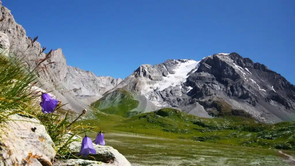
A long valley traversed by the Arc, the Mauritian It has been one of the major routes for crossing the Western Alps since antiquity.
His story is inseparable from the Mont-Cenis.
Pilgrims, merchants, armies, sovereigns, and then travelers used this passage to move between the two sides of the Alps. Later came the railway, the Fréjus tunnel, and then the motorway.
De Saint-Jean-de-Maurienne In Bonneval-sur-Arc, the valley nevertheless retains an extraordinary diversity of landscapes and a remarkable religious heritage.
These six territories help us understand why we talk about Savoy Country is ultimately quite accurate: the common identity has never erased local identities.
1792: Savoy becomes French for the first time
When the French Revolution broke out in 1789, Savoy still belonged to the Kingdom of Sardinia.
Three years later, in September 1792French troops enter Savoy. The territory is annexed to the Republic and becomes the Mont-Blanc department.
For the first time, Savoy was therefore integrated into France.
The revolutionary period profoundly disrupted society. Sardinian administrative structures disappeared, privileges were abolished, and religious property was affected by revolutionary policies.
Administrative boundaries were also changed several times during the Revolution and the Empire, particularly after the annexation of Geneva to France.
This first French period lasted until the fall of Napoleon. The treaties of 1814 and especially of 1815 They finally restored the authority of the House of Savoy over the entire Savoyard territory. Historical syntheses thus place the period of French annexation between 1792 and 1815.
Savoy therefore returned to the Kingdom of Sardinia in 1815.
But Europe has changed.
From 1815 to 1860: the final decades of Sardinian Savoy
For the next forty-five years, Savoy remained attached to Turin.
The French border is at the gates of the territory and relations with Lyon, Grenoble and Geneva are naturally important, but politically the Savoyards are subjects of the King of Sardinia.
Meanwhile, Piedmont became the driving force behind a movement that would transform the Italian peninsula: the Risorgimento.
King Victor Emmanuel II and its president of the Council Camillo Cavour They want to unify Italy around the Kingdom of Piedmont-Sardinia. To drive Austria out of the north of the peninsula, they need a powerful ally.
This ally will be France. Napoleon III.
And that is where the destiny of Savoy changed definitively.
1860: Why did Savoy become French?
In 1858, Cavour and Napoleon III met secretly in Plombières. The following year, France intervened on the side of Piedmont-Sardinia in the war against Austria.
The victories at Magenta and Solferino paved the way for profound territorial changes in Italy.
In return for French aid, the question of the transfer of Nice and Savoy to France returns to the forefront.
Le Treaty of Turin of March 24, 1860 provides for their reunification with France, subject to the agreement of the populations concerned.
A vote is being held in Savoie on April 22 and 23, 1860The "yes" vote for annexation won overwhelmingly. However, the vote took place in the political context of the 19th century, very different from the standards of a contemporary election, and its conditions have been the subject of historical debate and fuel the autonomist aspirations of certain political groups.
The annexation became effective in June 1860.
A centuries-long political history comes to an end. The dynasty bearing the name of Savoy, however, continues its spectacular destiny: from the 1861Victor Emmanuel II becomes the first king of Italy.
Savoy, however, is now French.
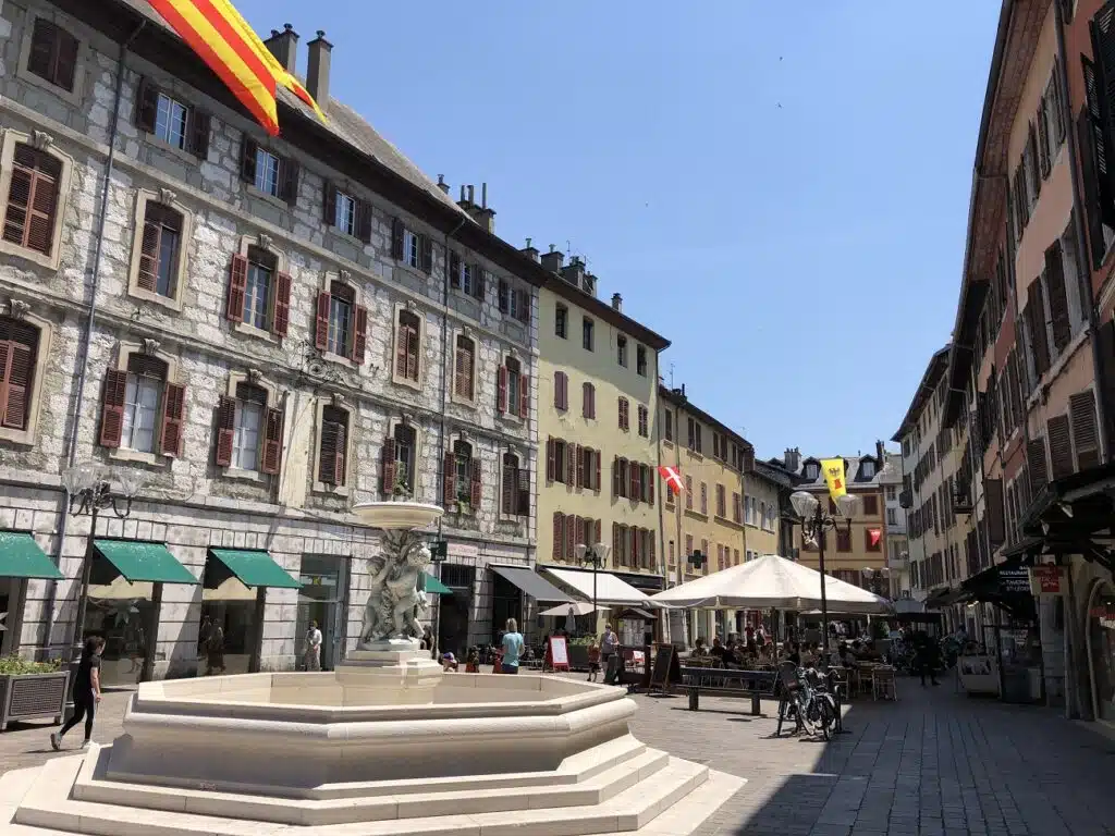
Why two departments: Savoie and Haute-Savoie?
France chose not to retain the former Savoyard territory as a single department.
Two departments are created.
To the south, the Savoie departmentof which Chambéry becomes the prefecture.
To the north, the department of Haute-Savoieof which Annecy becomes the prefecture.
This administrative separation still exists more than 160 years later.
It gradually produced two distinct political and economic realities. Haute-Savoie is today deeply influenced by Geneva, the Lake Geneva basin, and the dynamism of the Arve Valley. Savoie remains more structured by Chambéry, Albertville and the large valleys of Tarentaise and Maurienne.
However, the departmental border has never erased the shared history.
You just have to look at the flag.
The Savoy cross: the symbol of a shared history
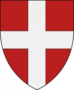
A white cross on a red background.
The symbol is absolutely simple and can be found everywhere: on buildings, car stickers, regional products, signs, sports patches or flags hanging from chalets.
This cross is the ancient emblem of the House of Savoy.
Its exact origin has given rise to several legendary tales, notably one that links it to a crusade and the aid provided to the emperor by a Count of Savoy. Historians are much more cautious about these later-constructed accounts.
What matters today is elsewhere.
The Savoy cross has become the main visual symbol of Savoyard identity, far beyond any dynastic reference.
It is found just as naturally in Haute-Savoie as in Savoie.
Does a Savoyard language exist?
Savoyard identity also has a linguistic dimension that is often overlooked.
Before the widespread adoption of French, populations spoke different variants of a language now generally referred to as Franco-Provençal ou arpitán.
It is neither a dialect of French nor of Occitan.
Its historical area extends far beyond Savoy: it notably includes part of French-speaking Switzerland, the Aosta Valley and various territories in eastern France.
And above all, there was no single "Savoyard dialect".
The variants sometimes changed significantly from one valley to another. The Alpine geography favored these particularities, and the dialect of Maurienne could differ considerably from that of Chablais or Genevois.
French has gradually become dominant in all uses, particularly with schooling and the social transformations of the 19th and 20th centuries.
Arpitan nevertheless remains present in the heritage, place names, certain expressions, and thanks to the work of associations that continue to transmit it. The phonetic transcription of Arpitan into French led to the creation of the endings "z" or "x," which actually serve as stress marks on the penultimate or last syllable. This stress pattern is respected in the Aosta Valley and Switzerland, but less so in France, where it's difficult to know in advance how to pronounce words. For example, one says Chamonix without pronouncing the x (Chamoni), but one says La Motte Servolex with the x. One says l'Arcluse for a spelling "arclusaz," but one says "La Clusa" for a spelling La Clusaz… That's how you can tell who is from Savoy and who isn't!
A culture shaped by the mountains
Does a common "Savoyard culture" therefore exist?
Yes, provided that it is not reduced to a few folkloric images.
The mountains have long imposed their constraints on the inhabitants: slopes difficult to cultivate, long winters, seasonal isolation, the need to preserve food and the fundamental importance of livestock farming.
From this geography arose a true agro-pastoral civilization.
The herds were moving up towards the pastures during the summer to free up the low-lying meadows needed for hay production. The milk was processed into cheese capable of being stored for several months. The forests provided building timber and fuel. The houses often brought together under one roof men, animals and the supplies needed to get through the winter.
But here again, each valley has developed its own solutions.
In the Beaufortain region, the abundance of wood is reflected in the architecture of the chalets. In the higher, more mineral valleys of the Maurienne, stone plays a more prominent role. The farms of the Chablais region don't exactly resemble the houses of the Tarentaise.
Savoy is common in its constraints and multifaceted in its solutions.
Beaufort, Reblochon, Abondance: the landscape can be eaten too
Few French territories maintain such an obvious relationship between gastronomy and landscape.
Beaufort cheese tells the story of the alpine pastures of the Beaufortain, Tarentaise, and Maurienne valleys. Abondance cheese evokes the pastures of the Chablais region. Reblochon cheese is intimately linked to the Aravis mountains.
These cheeses are not just culinary specialties: their production has helped to maintain open landscapes that would otherwise be gradually overtaken by the forest.
At a lower altitude, another Savoy appears.
Around Montmélian, Apremont, chignin or Jongieux, the Savoyard vineyards occupy the best exposed slopes. Jacquère, Altesse, Mondeuse and other grape varieties tell the story of a more southern mountain, made up of dry and sunny hillsides.
Gastronomic Savoy is therefore much more diverse than the winter image of fondue and raclette might suggest.
An architecture blending chalet, stone and baroque styles
Architecture is another excellent way to read the territory.
In mountain villages, the shape of the buildings primarily responded to agricultural needs and the climate. Large roofs, barns, stables and storage spaces often occupied more space than the dwelling itself.
But Savoy also has a particularly rich religious heritage.
In the 17th and 18th centuries, the Catholic Counter-Reformation It fostered the emergence of extraordinary Baroque art in the Alpine valleys. Behind sometimes austere facades lie altarpieces covered in gilding, twisted columns, and angels and saints in vibrant colors.
Tarentaise, Maurienne, Beaufortain and Val d'Arly still have many examples of this.
This abundance may seem surprising in small mountain villages. However, it reminds us that these valleys were not isolated from the world: artisans, artists, and influences circulated throughout the Alps.
Once again, the mountain was as much a passage as a border.

Is Savoy looking towards France or towards Italy?
The answer is obviously: both.
And we should even add Switzerland.
The geographical situation explains a large part of contemporary Savoyard identity.
Haute-Savoie is now closely integrated into the Geneva economic area. Lake Geneva creates a natural link with French-speaking Switzerland. Historically, relations with the Aosta Valley and Piedmont were equally important.
In Maurienne, Mont-Cenis has for centuries led travellers directly to Turin.
In Tarentaise, the Little St. Bernard opened the road to the Aosta Valley.
In the Chablais region, Lake Geneva provided access to Lausanne and Geneva.
Political borders have changed, but the crossings have remained.
This is perhaps what most profoundly distinguishes Savoy from other French territories: its history was built in the center of the Western Alps rather than on the periphery of France.
Will the Savoy region still exist in 2026?
The question deserves to be asked because the institutional response has changed recently.
Following the creation of the two departments in 1860, various forms of cooperation naturally developed between them. 2001The general councils of Savoie and Haute-Savoie had taken a further step by creating theAssembly of the Pays de Savoie, intended to support several policies together.
She then became the Savoie Mont Blanc Council.
For several years, the common logic was pushed quite far, particularly in tourism with shared promotion under the Savoie Mont Blanc brand.
But that period has ended.
The two departments gradually took over several previously shared responsibilities separately, and joint tourism promotion ceased. In Savoie, a new departmental tourism committee was thus established; the Department indicated in June 2025 that it would allocate €2,25 million to it to relaunch tourism promotion in Savoie "after the demise of the Savoie Mont Blanc Agency." Today, the brand Savoie Mont Blanc is no longer the joint institution representing the two departments..
And this evolution ultimately makes the concept of the Savoy region even more interesting.
Because it allows us to distinguish between two things that are not necessarily identical: the institution and the territory.
Two departments, but a story that doesn't stop at a border.
Administratively, Savoie and Haute-Savoie are now two separate departments, each with its own departmental council, policies, and territorial strategies. The Department of Savoie thus presents itself as a local authority exercising its own powers in social, road, environmental, educational, cultural, and sporting matters.
But try to mentally trace the border between the two departments in the Bauges.
Or between the Beaufortain and the Val d'Arly.
Look at the travel between Annecy, Aix-les-Bains and Chambéry, the links between the resorts, families, businesses or cultural practices.
The shared history has obviously not disappeared with the evolution of institutions.
The Savoy region therefore exists less as an administration than as a shared historical and cultural spaceitself composed of territories possessing very strong identities.
And that's probably the best definition we can give it today.
So, what are the Savoy region?
These are two French departments, but their history begins long before their creation.
These are mountains, but also cities, vineyards and large lakes.
These include Chambéry and Annecy, but also Chablais, Faucigny, Beaufortain, Tarentaise and Maurienne.
It is a white cross on a red background that can be found from Lake Geneva to Mont Cenis.
It is a historical language belonging to the Franco-Provençal domain, with agricultural traditions, cheeses, wines, architectures that differ from one valley to another, and an astonishing concentration of Baroque art deep in the mountains.
Above all, it is a territory whose history forces us to change the way we look at the map.
For centuries, Savoy was not located at the end of France. It was in the middle of a state straddling the Alps. Chambéry was its capital before power shifted to Turin. The same rulers were successively Counts of Savoy, Dukes of Savoy, and then Kings of Sardinia, before their dynasty provided Italy with its first king. Historical accounts meticulously trace this progression, from the medieval county to the duchy of 1416, then to the Sardinian states, and finally to the cession of 1860.
This story explains why borders seem less simple here than elsewhere.
Lake Geneva unites as much as it separates. The mountain passes facilitated the movement of people before becoming borders. Mont Cenis leads to Turin, the Little St. Bernard to the Aosta Valley, while Geneva lies immediately at the gateway to Haute-Savoie.
And perhaps that's precisely it. the identity of the Savoy region.
A common belonging strong enough to have survived border changes and administrative reorganizations, but diverse enough never to have erased the valleys and countries that make it up.
Today, there is no longer a political institution representing a unified whole called "Pays de Savoie".
Yet, when travelling from Lake Geneva to the Maurienne Valley, from Annecy to Chambéry or from Mont Blanc to Mont Cenis, something still connects these landscapes.
A story.
A culture.
And above all, this very Savoyard way of having always lived on both sides of the mountain rather than just on one side of the border.
Image Credits
Map of the Savoy region: Flappiefh, CC BY-SA 4.0 https://creativecommons.org/licenses/by-sa/4.0, via Wikimedia Commons // https://upload.wikimedia.org/wikipedia/commons/5/54/Pays_de_Savoie_relief_location_map.jpg?utm_source=commons.wikimedia.org&utm_campaign=index&utm_content=original
You might also be interested in these articles:
6 good reasons to stay in Méribel, the heart of the 3 Valleys
Discover 6 good reasons to stay in Méribel, in the heart of the 3 Valleys: skiing, Lake Tuéda, heritage, cycling and great landscapes.
A short historical walk to discover Chambéry
Discover the city of Chambéry through a chronological heritage tour. From the Gallo-Roman site to the ducal capital of the States of Savoy, and finally to the modern city, stroll through the old town.

Évian-les-Bains, a story of water on the French shore of Lake Geneva
People come to Evian for its water, its thermal baths, Lake Geneva, but also for its heritage. Discover it on a stroll.

Thonon-les-Bains, a discreet capital on the French shore of Lake Geneva
Discover Thono-les-Bains, a small town rich in history and heritage in a remarkable location on the French shore of Lake Geneva.

Saint-Jean-d'Arvey, this balcony of the Bauges mountains overlooking Chambéry
Saint Jean d'Arvey, situated on a sunny balcony overlooking Chambéry, provides easy access to the main sites of the Bauges.

What to do in Revard, the mountain of Aix-les-Bains?
Discover Mont Revard, a natural balcony overlooking Lake Bourget: panoramic views, Nordic and alpine skiing, hiking, family activities and access from Aix-les-Bains.

Barby, at the gateway to the Bauges mountains, very close to Chambéry
Discover Barby, a small village on the outskirts of Chambéry. Its landscape and heritage make it an excellent setting to relax for a while or to spend a lifetime.

Curienne, living at the rhythm of the mountains near Chambéry
Experience mountain life in Curienne, a stone's throw from Chambéry, at the gateway to the Bauges resorts.

Are you familiar with the 8 cheeses of the Savoie region?
Discover the 8 iconic cheeses of the Savoie region and how they are made.

Le Revard: the astonishing history of the Aix-les-Bains mountain
Discover the amazing history of Revard, this mountain resort that was a pioneer in many areas

Le Bourget-du-Lac: living between water, history and mountains
Le Bourget du Lac allows you to live on the shores of a lake in the heart of the Alps but also in the middle of the Chambéry employment area.

Four splendid gorges in the Savoie region to find some coolness
Rediscover the coolness at the bottom of the most beautiful gorges in the Savoie region: Pont du Diable, Diosaz, Fier and Sierroz

The Aix-les-Bains racecourse, this love of horses dating back to the Belle Époque
Discover the history of the Marlioz racecourse in Aix-les-Bains, the only racecourse in the Alps where you can watch horse races.

Chignin, vineyards just a stone's throw from Chambéry
Take a walk along the paths around Chignin, from one tower to another, amidst the Savoyard vineyards, facing the mountains.

Discover Tresserve, the elegant village overlooking Lake Bourget
Discover Tresserve, perched on its hill above Lake Bourget, a romantic village favored by Lamartine.
Discovering the Gorges du Fier, near Annecy
Near Annecy, discover the Gorges du Fier by venturing into its depths and admiring the shapes sculpted by the water.

Challes-les-Eaux: the elegance of a spa town on the outskirts of Chambéry
Discover Challes-les-Eaux, a former spa town, on the outskirts of Chambéry. Enjoy walks and the unique lifestyle of this town at the foot of the Bauges mountains.

Saint Pierre d'Albigny, the art of living between lake, vineyards and mountains
Discover Saint Pierre d'Albigny, in the heart of the Combe de Savoie. A village to unpack your bags for a break or for life.

4 unforgettable hikes in the Beaufortain
Discover these four easy hikes in the Beaufortain, with Mont Blanc as a backdrop, and admire breathtaking panoramas.

My articles on the heritage and history of the Alps
Find here all the articles I have written on the history of the Alps and the House of Savoy on the media “Nos Alpes”

3 hikes to discover the landscapes of Mont Blanc around Chamonix
Hike and discover the landscapes of Mont Blanc, near glaciers, with breathtaking views over the Chamonix Valley

The most beautiful hike around Avoriaz
Discover the landscapes of the Chablais region around Avoriaz, with its viewpoints, ridges, waterfalls, forests and lakes. Wild nature and beautiful scenery.
Five ideas for easy walks in the heart of the Bauges
Through the wooded valleys of the Bauges or along ridges with extraordinary panoramas, an invitation to this magnificent alpine region.
The six most inspiring sites in Savoie
Discover six of the most inspiring sites in Savoie, in the heart of the mountains, where the work of men meets the infinity of the sky.

Discover these 5 inspiring sites in Haute-Savoie
Discover five of the most beautiful sites in Haute-Savoie, one of the most beautiful French departments for lovers of Alpine landscapes.
Five regions of the French Alps to discover by train
Discover five beautiful regions of the French Alps, easily accessible by train. Hop off at your local station and enjoy the mountains!
The most beautiful passes in the Alps: Col du Galibier and Col du Lautaret
From Maurienne to Briançon, cross Galibier and Lautaret between fortresses, alpine villages and sublime landscapes.
What to visit in Maurienne: history, forts, passes and sacred valleys
Visit the Maurienne Valley: a valley of forts, pilgrims, and glaciers. A journey between geopolitics and Alpine history.
Itinerary in the Alps between France and Italy: Mont Cenis and Montgenèvre passes
Between Mont-Cenis and Montgenèvre, follow a thousand-year-old road between strategic passes, forgotten forts and Alpine towns steeped in history.

Most beautiful passes in the Alps: Col de l'Iseran
Route via the Col de l'Iseran, the highest road pass in the French Alps: landscapes, villages, stories and memories